

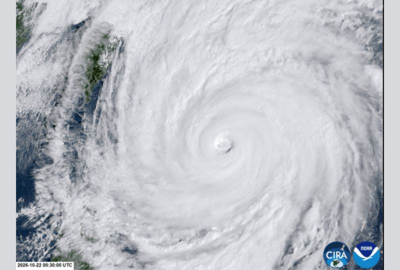
Almost all of Taiwan shut down yesterday with the approach of Typhoon Champi, which was already bringing strong winds and torrential rain, and, while weakening, could still make direct landfall on the island.
At one point a super typhoon and one of the strongest storms in the Pacific this year, Champi was still packing gusts of around 191kph near its centre, according to Taiwan’s Central Weather Administration (CWA).
The storm was about 170km east of Taiwan, the CWA said.
The storm’s forecast track shows it will pass just off northeastern Taiwan, turn north towards the Chinese coast and eventually move into southern Japan.
One person was killed and 163 were injured – a number revised down from 171 – as powerful wind and driving rain hit Taiwan, where the government said 2,639 people had been evacuated from mountainous areas.
Taipower said more than 77,000 homes had lost power, though electricity had already been restored to most.
TSMC, the world’s largest contract chipmaker, said operations remained normal with no significant impact.
CWA forecaster Liu Pei-teng told Reuters that landfall could not be ruled out if it ‘stalls, loops, or wobbles from side to side’ on approach to Taiwan.
“The storm’s wind radius is quite large, among the bigger ones in recent years,” Liu said.
“If the storm slows down, the strong winds will affect Taiwan for longer.”
Coastal towns received mobile phone alerts warning of gusts exceeding 150kph and urging residents to seek immediate shelter, while nearly a metre of rain was forecast for northern mountain areas, including around Taipei.
Taiwan forecasters said the storm’s radius was around 320km, large enough to cover most of Taiwan, and weather experts said its impact could last nearly two days.
